
- Home
- Workshops / Tours
- Diary / Blog
- Galleries
- Foreign Trips
- Tasmania 2016
- NE Queensland 2016
- Western Alps 2016
- NE Spain 2016
- Australia's Wet Tropics 2015
- Australia's Top End 2015
- SW Australia 2015
- Switzerland 2015
- Andalucia 2015
- Belize 2015
- Australia 2014
- Switzerland 2014
- Belize 2014
- Bahama Islands 2014
- Switzerland 2013
- Ecuador 2012-2013
- Florida 2011-2012
- Vancouver Island 2011
- Australia 2010
- Peru 2008
- Bulgaria 2007
- Lesvos 2006
- California 2006
- New Zealand 2005
- Extremadura 2005
- Goa, India 2004
- The Gambia 2003
New Zealand
5th November - 4th December 2005
The MacKenzie Basin & Mount Cook (Aoraki)
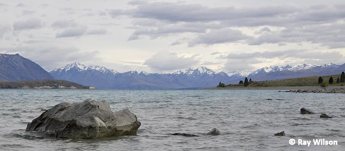
Lake Tekapo
The Mackenzie basin (named after a notorious sheep rustler), is home to one of the world's rarest shorebirds. The Black Stilt is a species I have been wanting to see ever since seeing a BBC documentary on them back in the late 80's. However, since the wild population is less than 100 birds you have to be especially careful that you do not disturb them, and the chances of finding one close enough to the road to be able to use the car as a hide are pretty small. After 2 days in the area, I did eventually manage to find a mixed flock of Black and Pied Stilts (as well as a few hybrids) at the head of Lake Pukaki, but they were far too distant for photography even with stacked 1.4x and 2x converters on my 600mm lens.
 |
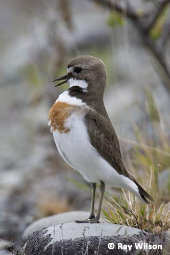 |
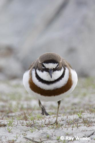
Double-banded Plover (Charadrius bicinctus) - male (left) and female (right)
Double-banded Plovers were far more obliging. These are another endemic shorebird but, unlike the Black Stilt, are fairly common and not at all shy.
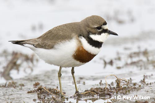
male Double-banded Plover (Charadrius bicinctus)
Another endemic that nests on the shingle banks is the Black-fronted Tern. It has suffered a large-scale population decline over the last 20 years and has recently been added to the endangered species list.
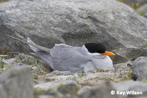
Black-fronted Tern (Sterna albostriata)
Black-billed Gulls, on the other hand, have been one of the few species endemic to New Zealand to have actually benefitted from the arrival of humans. The clearing of forests and the spread of agriculture have helped their spread.
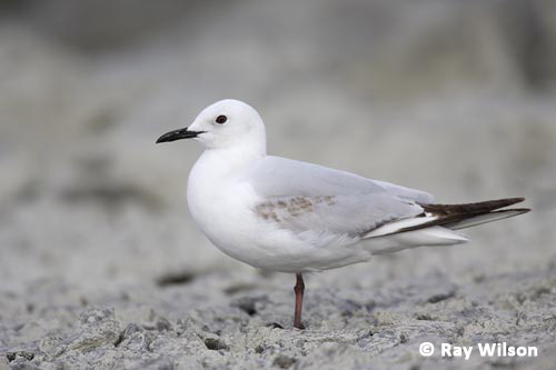
1st-summer Black-billed Gull (Larus bulleri)
The beautiful turquoise colour of the alpine lakes is caused by 'rock flour', a colloidal suspension of finely ground rock particles from the glacial melt waters.
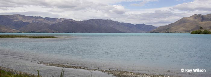
Lake Benmore
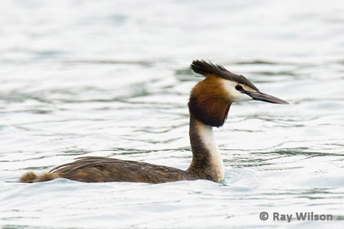
Great Crested Grebe (Podiceps cristatus australis)
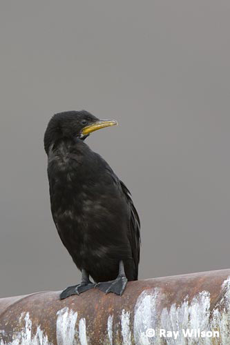 |
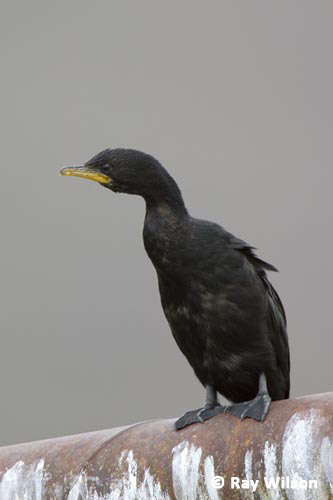 |
Little Shag (Phalacrocorax melanoleucos)
I may not have had any luck with the Black Stilts, but the Pied Stilts at Lake Benmore were reasonably cooperative...
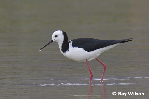
Pied Stilt (Himantopus leucocephalus)
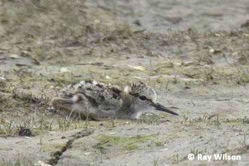
Pied Stilt (Himantopus leucocephalus) chick
Further up the valley from Lake Pukaki is Mount Cook National Park. Within the park bounderies are the highest peaks in the Southern Alps range, including New Zealand's highest mountain: Aoraki (Mount Cook). According to Maori legend, South Island was formed when the canoe carrying four sons of Raki, the sky god, ran aground on a hidden reef. The canoe settled in the water, listing to the east and turned to stone. The higher western side formed the Southern Alps and the four brothers who clambered on top of the canoe also turned to stone and formed the four highest peaks: Aoraki, Rakiroa (Mt. Dampier), Rakirua (Mt. Teichelmann) and Rarikiroa (Mt. Tasman).
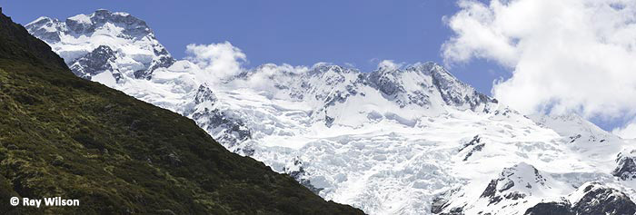
Mount Sefton (3151m), The Footstool (2764m) and the Mueller Glacier - as seen from Mount Cook Visitor's Centre
The above photo was taken during a brief break in the clouds. Unfortunately, the top 1000m of Mount Cook remained shrouded in cloud the whole afternoon. Today, at 3754m, Mount Cook is 10m lower than it was in 1991 when a massive rock avalanche shed 14 million cubic metres of rock and ice from its summit.
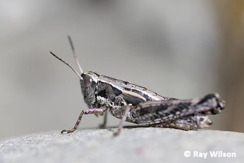
Probably a Northern Tussock Grasshopper (Paprides nitidus)
 |
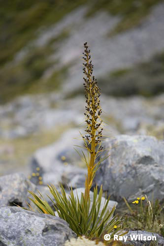 |
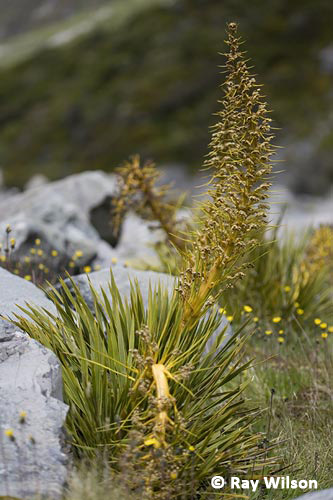
Spaniard sp. (Aciphylla sp.)
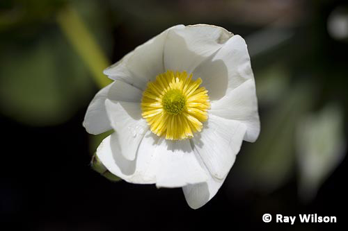
Giant Mountain Buttercup (Ranunculus lyallii)
| St. Anne's Lagoon | New Zealand map | Taiaroa Head |
Ray Wilson owns the copyright of all images on this site.
They may not be used or copied in any form without prior written permission.
raywilsonphotography@googlemail.com